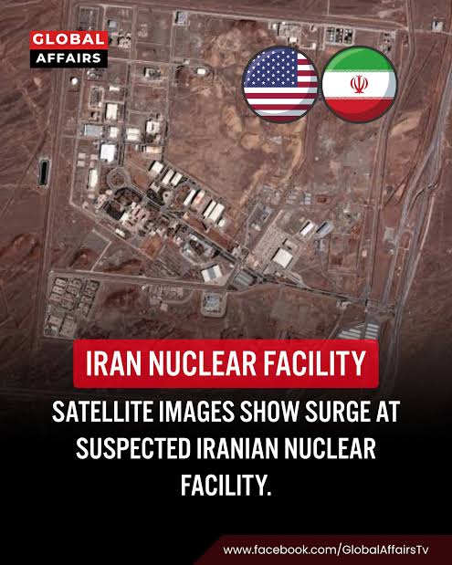
Iran’s underground nuclear infrastructure is once again at the center of international attention as new satellite imagery and recent reporting highlight activity around several sensitive facilities.
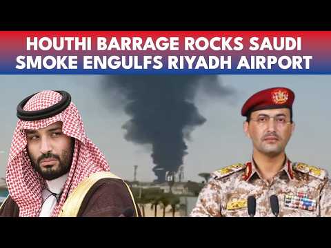
The developments come at a particularly tense moment for the Middle East. Iran warned on September 20 that any major new attack by the United States and its allies could trigger sustained retaliation against American bases and regional interests. The warning followed renewed attacks involving Saudi Arabia and Iranian-backed Houthi forces, adding another layer to an already unstable security environment.
Against this backdrop, imagery of Iran’s underground nuclear-related facilities has drawn fresh attention. Analysts have been examining sites including Pickaxe Mountain near Natanz, the Fordow enrichment facility, and Taleghan 2 at the Parchin military complex.
The images do not provide a complete picture of what is happening underground. However, analysts say they reveal construction, protective measures and changes around several strategically important locations.
Why Iran’s Underground Nuclear Sites Matter
Iran’s nuclear infrastructure has long been a major source of tension between Tehran and Western governments.
Some of the country’s most sensitive facilities were deliberately constructed underground or inside hardened areas. Such designs can make them more difficult to monitor and more resistant to air attacks.
Fordow is perhaps the best-known example. The facility was built inside a mountain near the city of Qom and became an important part of Iran’s uranium-enrichment program.
Natanz is another major nuclear complex. It contains above-ground and underground infrastructure associated with uranium enrichment.
More recently, Pickaxe Mountain, a tunnel complex near Natanz, has attracted increasing international attention. Western intelligence assessments have linked the underground location to the potential storage of nuclear material, although publicly available imagery cannot independently establish exactly what is currently inside the tunnels.
This distinction is important.
Satellite imagery can reveal roads, buildings, vehicles, construction equipment, tunnel entrances and defensive structures. It cannot automatically reveal whether a particular tunnel contains uranium, centrifuges or other nuclear-related equipment.
New Imagery Highlights Activity at Pickaxe Mountain
One of the most closely watched developments involves Pickaxe Mountain.
A September 17 analysis by the Institute for Science and International Security examined satellite imagery from September 11. It found that earthen roadblocks remained around western tunnel entrances.
According to the analysis, the restricted access pattern supports the assessment that the facility was not visibly operating at the time of the imagery. At the same time, analysts said the underground complex could contain valuable equipment or materials.
The imagery also showed additional soil placed over certain tunnel portals.
Such additional overburden can increase protection against aerial attacks. Analysts described the measures as part of a broader set of passive defenses around the facility.
The significance is therefore not simply that construction is occurring.
The larger issue is that Iran appears to be maintaining or strengthening protection around underground infrastructure that has attracted international scrutiny.
What Is Known About the Pickaxe Mountain Facility?
Pickaxe Mountain is located near the Natanz nuclear complex in central Iran.
The underground site has received increased attention because of its location and its potential connection to Iran’s nuclear program.
Recent satellite imagery has shown changes around the tunnel entrances. The Institute for Science and International Security reported that some entrances have remained blocked and that additional protective measures have been visible.
The institute’s analysis said the western tunnel entrances had roadblocks and that additional overburden had been placed around tunnel areas.
However, analysts have cautioned against drawing conclusions that cannot be confirmed from imagery alone.
There is no public satellite image that can definitively show the contents of a sealed underground tunnel.
That means reports about possible nuclear material at Pickaxe Mountain must be distinguished from confirmed observations of construction and defensive activity.
Fordow Remains a Major Focus
Fordow remains one of the most important locations in discussions about Iran’s nuclear program.
The underground enrichment facility was built inside a mountain, providing significant physical protection.
According to the Institute for Science and International Security, available imagery reviewed through mid-May 2026 did not show clear evidence of renewed access to or reconstruction of the underground enrichment plant itself. The four tunnel entrances were reported as remaining buried during that period.
At the same time, analysts identified activity around supporting infrastructure and additional passive defenses.
These observations are significant because Fordow has historically been considered particularly difficult to attack because of its underground construction.
The facility’s status has also become harder to establish independently because international inspectors have faced limitations in accessing affected Iranian nuclear sites.
The Challenge of Verifying Iran’s Nuclear Stockpile
One of the biggest questions surrounding Iran’s nuclear program concerns the location and condition of its enriched uranium.
Following the 2025 conflict and attacks on Iranian nuclear facilities, international inspectors have faced difficulties verifying the status of Iran’s nuclear material.
The Associated Press reported on September 17 that since the United States and Israel struck Iranian nuclear sites in June 2025, UN nuclear inspectors have been unable to verify the status of Iran’s enriched-uranium stockpile.
That uncertainty has made satellite imagery more important.
Commercial satellites can provide frequent views of sensitive locations. Analysts can compare images taken weeks or months apart and identify changes in roads, buildings, tunnel entrances and construction patterns.
But imagery remains an indirect source of information.
For that reason, satellite analysis is often combined with intelligence assessments, official statements and information from the International Atomic Energy Agency.
Taleghan 2 Adds Another Layer to the Story
Another facility attracting attention is Taleghan 2, located inside the Parchin military complex southeast of Tehran.
Recent satellite imagery examined by the Institute for Science and International Security showed extensive reconstruction activity at the site.
The Times of Israel reported that imagery from September 13 showed construction vehicles, cranes, concrete equipment and other machinery at Taleghan 2. The report said the site had previously been damaged in Israeli attacks.
Analysts have associated Taleghan 2 with Iran’s historical nuclear weapons research.
The site has been linked by Western intelligence assessments to activities connected to Iran’s former AMAD program. However, Iran has denied pursuing nuclear weapons.
The recent reconstruction therefore raises questions about Tehran’s intentions, but imagery alone does not establish that the rebuilt facility is currently being used for nuclear-weapons development.
Why Construction Is Drawing International Attention
Construction at sensitive sites becomes particularly important during periods of military confrontation.
A country may rebuild facilities for several reasons. It could restore damaged infrastructure, improve defensive protection, replace destroyed equipment or create alternative capabilities.
In Iran’s case, the situation is complicated by years of confrontation over its nuclear program.
The Institute for Science and International Security has described construction and defensive changes at several locations. Its June analysis said visible activity did not by itself prove renewed uranium enrichment and that further verification was required.
That distinction is crucial for responsible reporting.
Construction does not automatically equal enrichment.
Likewise, a reinforced tunnel does not automatically mean nuclear weapons are being produced underground.
IAEA Pressure Adds to the Tension
The nuclear dispute has also moved into the diplomatic arena.
On September 9, the International Atomic Energy Agency’s Board of Governors approved a resolution reporting Iran to the UN Security Council over what the agency described as breaches of its non-proliferation obligations.
Al Jazeera reported that this was the first such referral by the IAEA board in 20 years.
The development adds pressure on Tehran at a time when military tensions are already high.
The IAEA’s ability to verify Iran’s activities is central to the dispute.
Without reliable access to nuclear sites, international governments face greater uncertainty about what equipment remains operational, where nuclear material is located and whether reconstruction has restored previously damaged capabilities.
Regional Tensions Raise the Stakes
The nuclear issue cannot be separated from the wider military crisis in the Middle East.
On September 20, Iran warned that a major new US or allied attack would result in sustained retaliation against American bases and interests.
Reuters reported that the warning came amid renewed instability involving Saudi Arabia and Yemen’s Houthi movement. The United States had also issued a security alert warning Americans about the possibility of unforeseen escalation, including potential flight disruptions and airspace closures.
This wider conflict environment increases the importance of Iran’s underground infrastructure.
If military confrontation continues, hardened facilities could become potential targets.
At the same time, attacks against nuclear-related locations create additional concerns about radioactive contamination and regional environmental consequences.
Underground Facilities Create a Difficult Military Problem
Underground nuclear sites are difficult to monitor and, potentially, difficult to destroy.
Their depth, reinforced construction and mountain protection can complicate military planning.
Fordow illustrates the challenge particularly clearly. Its location inside a mountain has historically made it one of Iran’s most protected nuclear facilities.
Pickaxe Mountain presents a different but related challenge.
The facility consists of tunnel infrastructure that can potentially be used for storage or other activities. When entrances are blocked or reinforced, determining what is happening inside becomes more difficult.
This creates a major intelligence problem.
Governments must make assessments using incomplete information.
Commercial satellite imagery can show external changes, but underground activity remains largely hidden.
What the Latest Images Can and Cannot Prove
The phrase “dramatic new footage” can make satellite imagery sound more conclusive than it actually is.
The latest images provide evidence of visible changes around Iran’s nuclear-related facilities.
They show construction activity at some locations.
They show protective measures at others.
They also show that some tunnel entrances remain blocked.
However, they do not provide a complete inventory of Iran’s underground nuclear infrastructure.
They cannot independently establish the current location of every quantity of enriched uranium.
They cannot prove that uranium enrichment is taking place inside a particular tunnel.
And they cannot by themselves establish whether a rebuilt facility is being used for weapons development.
Those questions require additional intelligence and, most importantly, verifiable inspection access.
Why Satellite Imagery Has Become So Important
Satellite imagery has become an increasingly important tool in monitoring nuclear programs around the world.
Analysts can compare images over time to identify changes that may otherwise remain unnoticed.
For Iran, imagery has been especially valuable because access to several sensitive sites has become difficult.
Recent analyses have identified:
- Construction activity at Taleghan 2.
- Defensive measures around Natanz.
- Blocked or protected tunnel entrances at Pickaxe Mountain.
- Defensive changes around Fordow.
- Continued activity around supporting infrastructure.
These observations help analysts build a broader picture of Iran’s nuclear infrastructure.
Still, imagery should be interpreted alongside official inspection data and other independent evidence.
The Diplomatic Dimension
The nuclear dispute remains more than a military issue.
Diplomacy continues to play a central role because a verifiable nuclear agreement could potentially reduce uncertainty without relying exclusively on military action.
Iranian officials have continued to emphasize diplomacy while also warning that they will respond to military pressure.
On September 20, Iranian Foreign Minister Abbas Araghchi said diplomacy and power were not necessarily in conflict, according to Iranian state-linked reporting.
The international community therefore faces a complicated challenge.
It must address concerns about Iran’s nuclear activities while also dealing with the broader regional conflict.
What Happens Next?
Several developments will be closely watched.
First, analysts will monitor new satellite imagery from Pickaxe Mountain, Natanz and Fordow.
Second, international governments will watch for signs of reconstruction or renewed access to underground facilities.
Third, the IAEA’s ability to obtain information and inspection access will remain important.
Finally, military developments could quickly change the situation.
A new attack could accelerate reconstruction, increase defensive measures or further restrict international inspections.
A diplomatic breakthrough could produce the opposite effect by opening pathways for verification.
Bottom Line
Iran’s underground nuclear sites are receiving renewed attention because satellite imagery is showing construction and defensive changes at several strategically important facilities.
Pickaxe Mountain, Fordow, Natanz and Taleghan 2 are now central to discussions about Iran’s nuclear infrastructure.
The available imagery provides important clues, but it does not answer every question.
In particular, it does not independently establish what is currently stored inside sealed tunnels or whether nuclear enrichment is taking place at a specific underground location.
That uncertainty is precisely why international inspections and independent verification remain important.
With Iran warning of retaliation against any new US or allied attack and regional tensions spreading across multiple fronts, developments around the country’s underground facilities will remain a major focus of Middle East security reporting.
FAQs
What are Iran’s main underground nuclear sites?
Important underground or hardened sites associated with Iran’s nuclear infrastructure include Fordow and the tunnel complexes around Pickaxe Mountain near Natanz. Other sensitive military facilities, including Taleghan 2 at Parchin, have also attracted attention because of their historical connections to Iran’s nuclear activities.
What is Pickaxe Mountain?
Pickaxe Mountain is an underground tunnel complex near Iran’s Natanz nuclear facility. Recent satellite imagery has shown blocked tunnel entrances and additional protective measures. Western intelligence assessments have linked the site to possible storage of nuclear material, although its current contents have not been independently established publicly.
Is Iran currently enriching uranium underground?
Public satellite imagery alone does not establish that uranium enrichment is currently taking place at a particular underground facility. Analysts have reported construction and defensive activity, but these observations should not automatically be interpreted as proof of active enrichment.
Why is Fordow important?
Fordow is a major Iranian enrichment facility built inside a mountain near Qom. Its underground design provides substantial physical protection, making it one of the most closely watched parts of Iran’s nuclear infrastructure.
What is happening at Taleghan 2?
Recent satellite imagery has shown substantial reconstruction activity at Taleghan 2 inside the Parchin military complex. Analysts have highlighted the site’s history and previous links to Iran’s alleged nuclear weapons research, while noting that the imagery itself does not prove its current purpose.
Why can satellite images not confirm what is underground?
Satellite imagery primarily shows external features such as buildings, roads, vehicles, construction work and tunnel entrances. It generally cannot reveal the contents of deeply buried facilities. Analysts therefore combine imagery with inspection data, intelligence assessments and other evidence.
Why is the IAEA important in the Iran nuclear dispute?
The International Atomic Energy Agency is responsible for monitoring nuclear activities under international safeguards. Its ability to access sites and verify nuclear material is important because satellite imagery cannot provide a complete picture of underground operations.
Could rising regional tensions affect Iran’s nuclear facilities?
Yes. Continued military escalation could affect the security, accessibility and reconstruction of nuclear-related facilities. It could also make international inspections more difficult. The exact consequences would depend on future military and diplomatic developments.
What should readers watch next?
Key developments include new satellite imagery around Pickaxe Mountain, Fordow and Natanz; IAEA statements about inspection access; evidence of further reconstruction; and diplomatic or military developments involving Iran, the United States and other regional actors.
About the Author